Local Street History
Where does your street name come from?
In our area some of our streets are named after pioneering families, local landmarks and activities long passed. Passed but not forgotten.
Looking at a local titles map from the 1900's it would appear that there were tracks or early roads crossing the local district, separating various portions of farmland. The early Sandgate road and the government road that became Elliott road in the west. Nudgee road in the east. What became St Vincents road and Northgate Roads running through the middle. What later became Tufnell Road, Redhill Road and Beehive Road (through the current catholic university & seminary site) run across the vicinity.
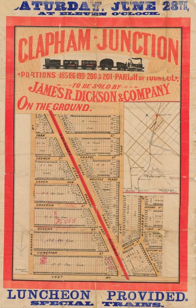 A James R Dickson & Co sales map from Sat June 28th (1890 ?) or clearly shows the streets of the original Clapham Junction Sales Estate with streets running off Royal Parades East and West (on each side of the train line).
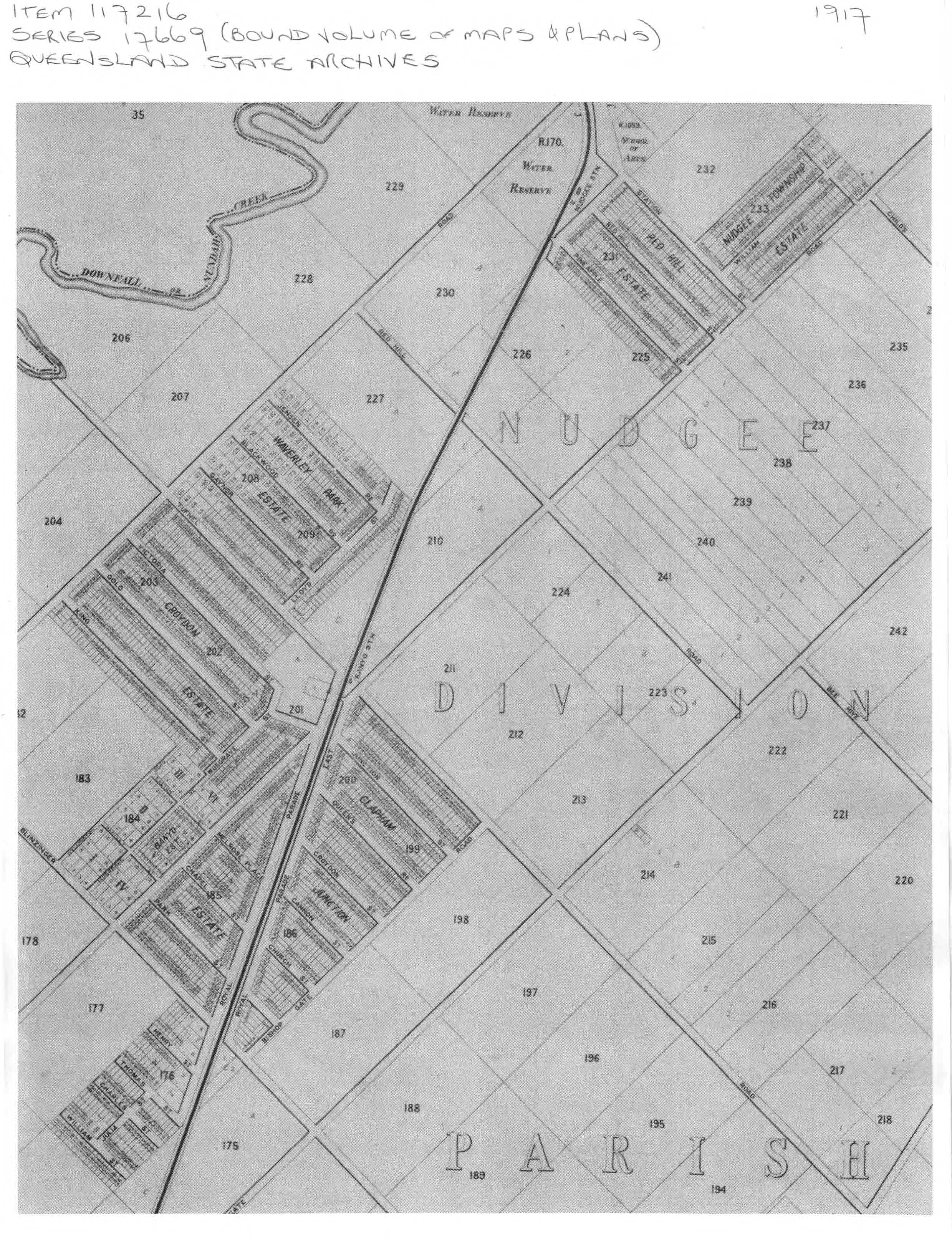
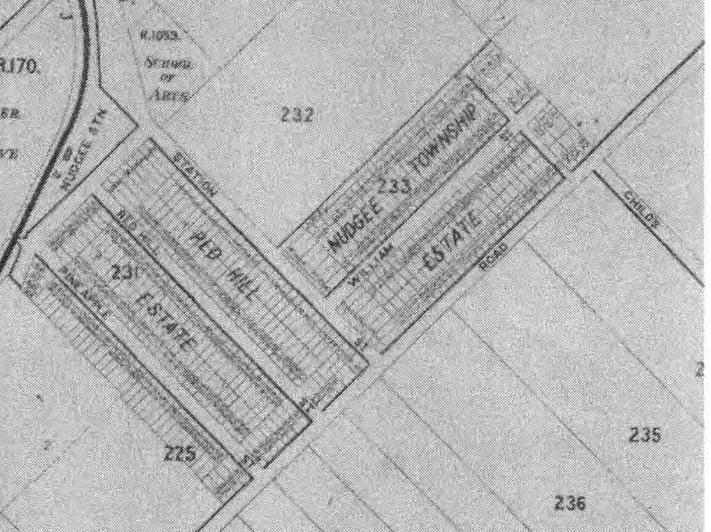
Examination of a Metropolitan Water Supply & Sewerage Board map of the district from 1917 shows more streets and new subdivisions marked out around the Banyo and Nudgee railway stations. Nudgee had the Red Hill and Nudgee Township Estate, while Banyo had the Clapham Junction, Croydon and Waverly Park Estates.
Some of our local streets have had their names changed. In the 1930's the newly amalgamated Brisbane City Council changed some local street names that were now duplicated across the new municipality inherited from a number of previous town and shire councils. By way of example, the new Brisbane council now had 30 streets named William.
The new council resolved to rename duplicated street names. In our northern part of Brisbane, names of Australian public dignitaries were used. In other parts of Brisbane aboriginal names, british empire leaders, british monarchs and empire cities and australian pioneers were originally used.
Later in the 1940s australian pioneers and aboriginal street names were used in northern suburbs.
We are looking to build a library detailing the history of the street names in our community and welcome your contributions. Do you know where your street name came from? Please let us know.
Sorry Individual Street Names Historical Index under repair
- Find out more about Banyo's street names
- Find out more about Nudgee's street names
- Find out more about Nudgee Beach's street names
- Find out more about Virginia's steeet names
This project relies on community contributions with both anecdotal and documentary references.
Anyone who provides information will be acknowledged.
Special Acknowledgements and Thanks should go to:
-
Elizabeth Nunn for researching State Archives for us.
-
Nundah and Districts Historical SocietyInc, mailto:nundahhistoricalsoc@bigpond.com, PO Box 451 Nundah Qld 4012, Ph 32606703
-
Former Councillor Kim Flesser
Contributions can be submitted to history@banyo.qld.au
Looking forward to Banyo Community Carols 2023
more information will be provided closer to the event date.